Geolocate

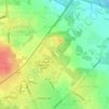
Shevington topographic map

Click on the map to display elevation.

About this map

Name: Shevington topographic map, elevation, terrain.

Location: Shevington, Wigan, Greater Manchester, England, WN6 8HB, United Kingdom (53.55099 -2.71261 53.59099 -2.67261)

Average elevation: 63 m

Minimum elevation: 16 m

Maximum elevation: 124 m

England trails, hiking, mountain biking, running and outdoor activities

Other topographic maps

Click on a map to view its topography, its elevation and its terrain.
Three Sisters Lake

United Kingdom > England > Wigan > Bryn

Average elevation: 50 m

Haigh

United Kingdom > England > Wigan > Haigh

Average elevation: 103 m

Lilford Woods

United Kingdom > England > Wigan > Howe Bridge > Lilford

Average elevation: 33 m

Gear up for your next adventure:

👕Merino Base Layers - Natural temperature regulation for cold weather hiking and camping
🧤Hiking Gloves - Warm and durable gloves for cold-weather walks
🧰Survival Kits - Emergency tools for remote environments
🧴Tick Removal Tools - Small, essential health tool for UK woodland and moorland
🥾Hiking Boot Waterproofing Wax - Maintain the lifespan of your leather trekking boots

As an Amazon Associate, this site earns from qualifying purchases at no extra cost to you.