Geolocate

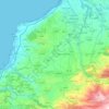
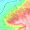
Kfifan topographic map

Click on the map to display elevation.

About this map

Name: Kfifan topographic map, elevation, terrain.

Location: Kfifan, Kfifane, Batroun District, North Governorate, 4201, Lebanon (34.21083 35.69861 34.25083 35.73861)

Average elevation: 387 m

Minimum elevation: 193 m

Maximum elevation: 616 m

Other topographic maps

Click on a map to view its topography, its elevation and its terrain.

Beddaoui

Lebanon > North Governorate

Average elevation: 70 m

Mrah Shdid

Lebanon > North Governorate

Average elevation: 339 m

Hamat

Lebanon > North Governorate

Average elevation: 120 m

Bcharreh Cedars of God Forest

Lebanon > North Governorate > El Arz

Time, along with the exploitation of the wood and the effects of climate change, has led to a decrease in the number of cedar trees in Lebanon. However, Lebanon is still widely known for its cedar tree history, as they are the emblem of the country and the symbol of the Lebanese flag. The remaining trees…

Average elevation: 1,959 m

Batroun

Lebanon > North Governorate

Average elevation: 31 m

Hadath El Jebbeh

Lebanon > North Governorate

Average elevation: 1,462 m

Tripoli

Lebanon > North Governorate

The urban form of Mamluk Tripoli was dictated mainly by climate, site configuration, defense, and urban aesthetics. The layout of major thoroughfares was set according to prevailing winds and topography. The city had no fortifications, but heavy building construction characterized by compact urban forms,…

Average elevation: 42 m

Bqaa Kafra

Lebanon > North Governorate

Average elevation: 1,883 m

Ram

Lebanon > North Governorate

Average elevation: 1,096 m

Kour

Lebanon > North Governorate

Average elevation: 359 m

Koura District

Lebanon > North Governorate

Average elevation: 297 m

Zgharta District

Lebanon > North Governorate

The district at elevations from 40–2,550 metres (130–8,370 ft), from near the coast to its highest point in the Mount Lebanon mountain range.

Average elevation: 527 m

Qalamoun

Lebanon > North Governorate

Average elevation: 106 m

Hamat

Lebanon > North Governorate

Average elevation: 120 m

Rashana

Lebanon > North Governorate

Average elevation: 226 m

Bcharre

Lebanon > North Governorate

Average elevation: 2,200 m

Wadi Qadisha

Lebanon > North Governorate > Ehden

Average elevation: 1,291 m

Deddeh

Lebanon > North Governorate

Average elevation: 217 m

Tripoli

Lebanon > North Governorate

The urban form of Mamluk Tripoli was dictated mainly by climate, site configuration, defense, and urban aesthetics. The layout of major thoroughfares was set according to prevailing winds and topography. The city had no fortifications, but heavy building construction characterized by compact urban forms,…

Average elevation: 42 m

Batroun

Lebanon > North Governorate

Average elevation: 31 m

Amioun

Lebanon > North Governorate

Average elevation: 335 m

Chekka

Lebanon > North Governorate

Average elevation: 110 m

Wadi Qadisha

Lebanon > North Governorate > Ehden

Average elevation: 1,342 m

Bqaa Kafra

Lebanon > North Governorate

Average elevation: 1,883 m

Qalhat

Lebanon > North Governorate

Average elevation: 226 m

Amioun

Lebanon > North Governorate

Average elevation: 335 m

Tripoli

Lebanon > North Governorate

The urban form of Mamluk Tripoli was dictated mainly by climate, site configuration, defense, and urban aesthetics. The layout of major thoroughfares was set according to prevailing winds and topography. The city had no fortifications, but heavy building construction characterized by compact urban forms,…

Average elevation: 42 m

Fiaa

Lebanon > North Governorate

Average elevation: 323 m

Selaata

Lebanon > North Governorate

Average elevation: 54 m

Miniyeh

Lebanon > North Governorate

Miniyeh (Arabic: المنية, French: Minieh) is the capital of the Miniyeh-Danniyeh District in North Governorate of Lebanon. Minya is located 96 km from Beirut at an altitude of 20 m above sea level.

Average elevation: 30 m

Barsa

Lebanon > North Governorate

Average elevation: 176 m

Al Tell Square

Lebanon > North Governorate > Tripoli

Average elevation: 30 m

Koura District

Lebanon > North Governorate

Average elevation: 284 m

Deddeh

Lebanon > North Governorate

Average elevation: 217 m

Mseilha Dam

Lebanon > North Governorate > Hamat

Average elevation: 198 m

Ras Masqa

Lebanon > North Governorate

Average elevation: 116 m

Gear up for your next adventure:

🔋Solar Chargers - Eco-friendly charging solutions for outdoor use
🧼Technical Clothing Wash - Special soap to clean and restore waterproof membranes
📸Action Camera Chest Mounts - Record your ascent following topographic paths hands-free
🦯Walking Poles - Supportive poles for long-distance walking
🧣Fleece Neck Warmers - Extra insulation for winter topographic surveys

As an Amazon Associate, this site earns from qualifying purchases at no extra cost to you.