
Pfeffikon topographic map
Interactive map
Click on the map to display elevation.
About this map
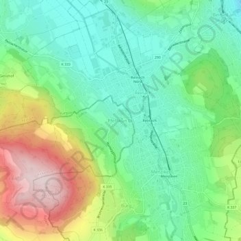
Name: Pfeffikon topographic map, elevation, terrain.
Location: Pfeffikon, Rickenbach, Luzern, 6221, Zwitserland (47.22938 8.15735 47.26938 8.19735)
Average elevation: 611 m
Minimum elevation: 474 m
Maximum elevation: 872 m
Other topographic maps
Click on a map to view its topography, its elevation and its terrain.
Meierskappel
Zwitserland > Luzern > Meierskappel
Meierskappel, Luzern, 6344, Zwitserland
Average elevation: 505 m
Hergiswil bei Willisau
Zwitserland > Luzern > Hergiswil bei Willisau
Hergiswil bei Willisau, Luzern, 6133, Zwitserland
Average elevation: 864 m
Rooterberg
Zwitserland > Luzern > Root
Rooterberg, Root, Luzern, 6037, Zwitserland
Average elevation: 648 m