Geolocate

Patan topographic map

Click on the map to display elevation.

About this map

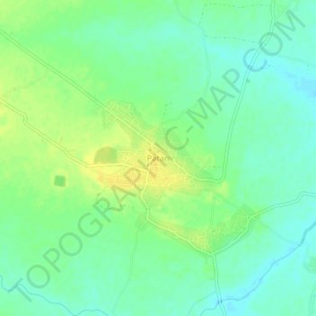
Name: Patan topographic map, elevation, terrain.

Location: Patan, Patan Tahsil, Durg, Chhattisgarh, 491111, India (21.01923 81.52362 21.05923 81.56362)

Average elevation: 295 m

Minimum elevation: 285 m

Maximum elevation: 307 m

Other topographic maps

Click on a map to view its topography, its elevation and its terrain.

Kharun River

India > Chhattisgarh > Patan Tahsil

Average elevation: 292 m

Gear up for your next adventure:

🦯Walking Poles - Supportive poles for long-distance walking
📍Handheld GPS Navigators - Reliable satellite navigation for hiking and off-road exploration
🧭Professional Hiking Compasses - High-precision liquid-filled compasses for map reading and orientation
🎒Multi-day Trekking Packs - Large capacity backpacks for wild camping and long-distance trails
🗺️Ordnance Survey Maps - Official UK maps for walking and outdoor activities

As an Amazon Associate, this site earns from qualifying purchases at no extra cost to you.