
Ocotepec topographic map
Interactive map
Click on the map to display elevation.
About this map
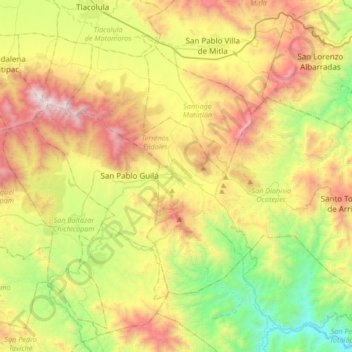
Name: Ocotepec topographic map, elevation, terrain.
Location: Ocotepec, San Dionisio Ocotepec, Oaxaca, 70495, Mexico (16.64192 -96.55597 16.96192 -96.23597)
Average elevation: 1,716 m
Minimum elevation: 869 m
Maximum elevation: 2,923 m