
Gostycyn topographic map
Interactive map
Click on the map to display elevation.
About this map
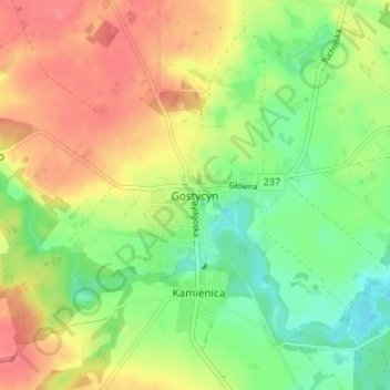
Name: Gostycyn topographic map, elevation, terrain.
Average elevation: 117 m
Minimum elevation: 85 m
Maximum elevation: 150 m
Other topographic maps
Click on a map to view its topography, its elevation and its terrain.
Huby
Poland > Kuyavian-Pomeranian Voivodeship > Tuchola County > Mały Mędromierz
Huby, Mały Mędromierz, gmina Tuchola, Tuchola County, Kuyavian-Pomeranian Voivodeship, 89-500, Poland
Average elevation: 140 m