Geolocate

Enterprise topographic map

Click on the map to display elevation.

About this map

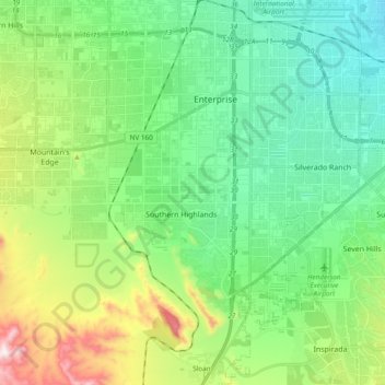
Name: Enterprise topographic map, elevation, terrain.

Location: Enterprise, Clark County, Nevada, United States (35.92896 -115.34511 36.07689 -115.15440)

Average elevation: 773 m

Minimum elevation: 599 m

Maximum elevation: 1,222 m

Gear up for your next adventure:

🧭Orienteering Compasses - Accurate compasses for map-based navigation
🛰️Handheld GPS Devices - Reliable GPS units for hiking and outdoor navigation
🎒Hiking Daypacks - Compact backpacks ideal for short hikes and excursions
📻Hand-Crank Emergency Radios - Stay updated on weather warnings in remote areas
🥾Hiking Boots - Waterproof and durable boots for long-distance hiking in the UK

As an Amazon Associate, this site earns from qualifying purchases at no extra cost to you.