
Thank you for supporting this site ❤️
Make a donation
Make a donation
Gear up for your next adventure:
As an Amazon Associate, this site earns from qualifying purchases at no extra cost to you.
Colcamar topographic map
Click on the map to display elevation.
Thank you for supporting this site ❤️
Make a donation
Make a donation
Gear up for your next adventure:
As an Amazon Associate, this site earns from qualifying purchases at no extra cost to you.
About this map
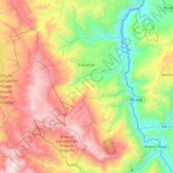
Name: Colcamar topographic map, elevation, terrain.
Location: Colcamar, Provincia de Luya, Amazonas, 01420, Perú (-6.38160 -78.08837 -6.25681 -77.93137)
Average elevation: 2,655 m
Minimum elevation: 1,705 m
Maximum elevation: 3,745 m
Thank you for supporting this site ❤️
Make a donation
Make a donation
Gear up for your next adventure:
As an Amazon Associate, this site earns from qualifying purchases at no extra cost to you.