
Paterson Great Falls National Historical Park topographic map
Interactive map
Click on the map to display elevation.
About this map
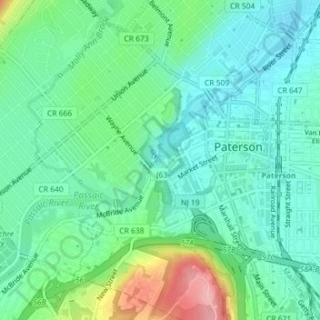
Name: Paterson Great Falls National Historical Park topographic map, elevation, terrain.
Average elevation: 45 m
Minimum elevation: 9 m
Maximum elevation: 145 m
Other topographic maps
Click on a map to view its topography, its elevation and its terrain.
Paterson
United States > New Jersey > Passaic County > Paterson
Paterson, Passaic County, New Jersey, 07505, United States
Average elevation: 74 m