
Neufeld an der Leitha topographic map
Interactive map
Click on the map to display elevation.
About this map
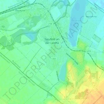
Name: Neufeld an der Leitha topographic map, elevation, terrain.
Average elevation: 234 m
Minimum elevation: 222 m
Maximum elevation: 254 m
Other topographic maps
Click on a map to view its topography, its elevation and its terrain.
Zagersdorf/Cogrštof
Austria > Burgenland > Bezirk Eisenstadt-Umgebung
Zagersdorf/Cogrštof, Bezirk Eisenstadt-Umgebung, Burgenland, 7012, Austria
Average elevation: 211 m