
l'Ormetrou topographic map
Interactive map
Click on the map to display elevation.
About this map
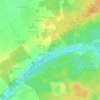
Name: l'Ormetrou topographic map, elevation, terrain.
Average elevation: 89 m
Minimum elevation: 72 m
Maximum elevation: 106 m
Other topographic maps
Click on a map to view its topography, its elevation and its terrain.
Château de Chambord
France > Centre-Val de Loire > Loir-et-Cher > Chambord > Le Bourg
Château de Chambord, Avenue du Roi, Le Bourg, Chambord, Blois, Loir-et-Cher, Centre-Val de Loire, France métropolitaine, 41250, France
Average elevation: 86 m
Le Château
France > Centre-Val de Loire > Loir-et-Cher > Chambord
Le Château, Chambord, Blois, Loir-et-Cher, Centre-Val de Loire, France métropolitaine, 41250, France
Average elevation: 89 m