
Eschenberg topographic map
Interactive map
Click on the map to display elevation.
About this map
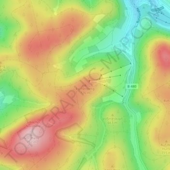
Name: Eschenberg topographic map, elevation, terrain.
Average elevation: 662 m
Minimum elevation: 531 m
Maximum elevation: 787 m
Other topographic maps
Click on a map to view its topography, its elevation and its terrain.
Winterberg
Deutschland > Nordrhein-Westfalen > Hochsauerlandkreis > Winterberg > Winterberg
Winterberg, Hochsauerlandkreis, Nordrhein-Westfalen, 59955, Deutschland
Average elevation: 648 m