
Cape Roca topographic map
Click on the map to display elevation.
About this map
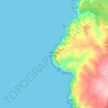
Name: Cape Roca topographic map, elevation, terrain.
Location: Cape Roca, Colares, Sintra, Lisbon, 2705-001, Portugal (38.77090 -9.50942 38.79090 -9.48942)
Average elevation: 50 m
Minimum elevation: -2 m
Maximum elevation: 219 m