
Thank you for supporting this site ❤️
Make a donation
Make a donation
Gear up for your next adventure:
As an Amazon Associate, this site earns from qualifying purchases at no extra cost to you.
Mwera topographic map
Click on the map to display elevation.
Thank you for supporting this site ❤️
Make a donation
Make a donation
Gear up for your next adventure:
As an Amazon Associate, this site earns from qualifying purchases at no extra cost to you.
About this map
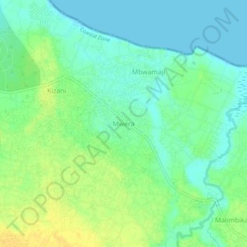
Name: Mwera topographic map, elevation, terrain.
Location: Mwera, Dar es Salaam, Coastal Zone, Tanzania (-6.89663 39.39139 -6.85663 39.43139)
Average elevation: 10 m
Minimum elevation: 0 m
Maximum elevation: 25 m
Thank you for supporting this site ❤️
Make a donation
Make a donation
Gear up for your next adventure:
As an Amazon Associate, this site earns from qualifying purchases at no extra cost to you.