
Ramdane Djamel topographic map
Interactive map
Click on the map to display elevation.
About this map
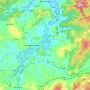
Name: Ramdane Djamel topographic map, elevation, terrain.
Location: Ramdane Djamel, Ramdane Djamel District, Skikda, 21425, Algeria (36.70204 6.80456 36.80946 7.03121)
Average elevation: 144 m
Minimum elevation: 7 m
Maximum elevation: 606 m