
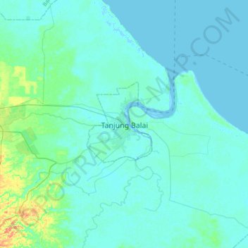
Tanjung Balai topographic map
Interactive map
Click on the map to display elevation.
About this map
Name: Tanjung Balai topographic map, elevation, terrain.
Average elevation: 5 m
Minimum elevation: -2 m
Maximum elevation: 39 m
Other topographic maps
Click on a map to view its topography, its elevation and its terrain.
Mata Halasan
Indonesia > North Sumatra > City of Tanjung Balai
Mata Halasan, City of Tanjung Balai, North Sumatra, 21314, Indonesia
Average elevation: 3 m
Keramat Kubah
Indonesia > North Sumatra > City of Tanjung Balai > Keramat Kubah
Keramat Kubah, City of Tanjung Balai, North Sumatra, 21362, Indonesia
Average elevation: 3 m