
دهستان بندر امام خمینی topographic map
Interactive map
Click on the map to display elevation.
About this map
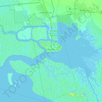
Name: دهستان بندر امام خمینی topographic map, elevation, terrain.
Average elevation: 2 m
Minimum elevation: -11 m
Maximum elevation: 19 m
Other topographic maps
Click on a map to view its topography, its elevation and its terrain.
Chamran Town
Iran > Khuzestan Province > Bandar-e-Mahshahr County > دهستان جراحی
Chamran Town, دهستان جراحی, بخش مرکزی, Bandar-e-Mahshahr County, Khuzestan Province, Iran
Average elevation: 13 m