
新城子镇 topographic map
Interactive map
Click on the map to display elevation.
About this map
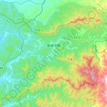
Name: 新城子镇 topographic map, elevation, terrain.
Location: 新城子镇, 密云区, 北京市, 中国 (40.55959 117.25966 40.68557 117.50799)
Average elevation: 619 m
Minimum elevation: 210 m
Maximum elevation: 1,830 m
Other topographic maps
Click on a map to view its topography, its elevation and its terrain.