
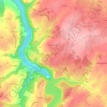
La Jarrige topographic map
Interactive map
Click on the map to display elevation.
About this map
Name: La Jarrige topographic map, elevation, terrain.
Average elevation: 236 m
Minimum elevation: 140 m
Maximum elevation: 284 m
Other topographic maps
Click on a map to view its topography, its elevation and its terrain.
Lac de Chambon
France > Centre-Val de Loire > Indre > Cuzion
Lac de Chambon, Cuzion, Châteauroux, Indre, Centre-Val de Loire, France métropolitaine, 36190, France
Average elevation: 237 m