
완장천 topographic map
Interactive map
Click on the map to display elevation.
About this map
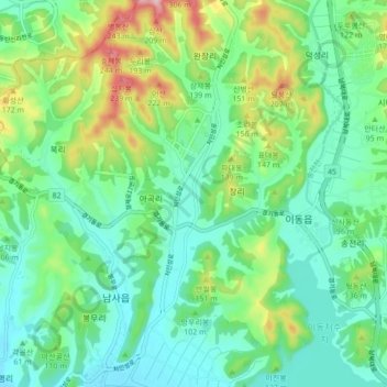
Name: 완장천 topographic map, elevation, terrain.
Location: 완장천, Cheoin-gu, Yongin-si, 17117, South Korea (37.11120 127.15741 37.17985 127.18275)
Average elevation: 85 m
Minimum elevation: 23 m
Maximum elevation: 244 m
Other topographic maps
Click on a map to view its topography, its elevation and its terrain.