
West Monroe topographic map
Interactive map
Click on the map to display elevation.
About this map
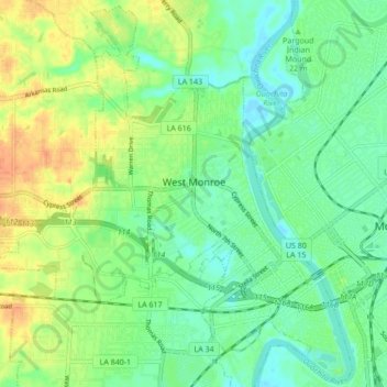
Name: West Monroe topographic map, elevation, terrain.
Location: West Monroe, Ouachita Parish, Louisiane, États-Unis (32.48125 -92.19823 32.55122 -92.11263)
Average elevation: 30 m
Minimum elevation: 15 m
Maximum elevation: 52 m