
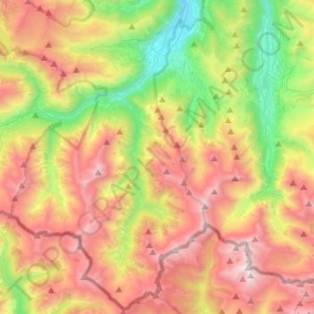
Saint-Lary-Soulan topographic map
Interactive map
Click on the map to display elevation.
About this map
Name: Saint-Lary-Soulan topographic map, elevation, terrain.
Average elevation: 1,864 m
Minimum elevation: 757 m
Maximum elevation: 3,147 m
Other topographic maps
Click on a map to view its topography, its elevation and its terrain.
Soulan
Frankreich > Okzitanien > Saint-Lary-Soulan
Soulan, Saint-Lary-Soulan, Bagnères-de-Bigorre, Hautes-Pyrénées, Okzitanien, Metropolitanes Frankreich, 65170, Frankreich
Average elevation: 2,160 m