
Chott el Djerid topographic map
Interactive map
Click on the map to display elevation.
About this map
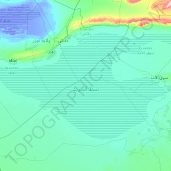
Name: Chott el Djerid topographic map, elevation, terrain.
Location: Chott el Djerid, Kébili, Tunisia (33.43752 7.77051 34.02513 8.90738)
Average elevation: 43 m
Minimum elevation: -27 m
Maximum elevation: 802 m
Other topographic maps
Click on a map to view its topography, its elevation and its terrain.