Geolocate

Lathi topographic map

Click on the map to display elevation.

About this map

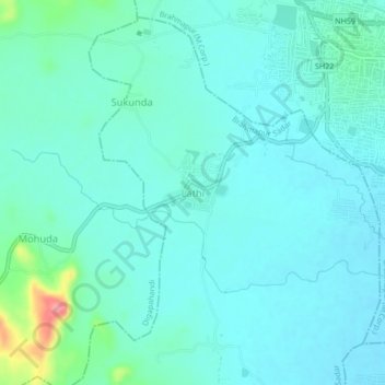
Name: Lathi topographic map, elevation, terrain.

Location: Lathi, Brahmapur Sadar, Ganjam, Odisha, 760002, India (19.28200 84.73809 19.32200 84.77809)

Average elevation: 33 m

Minimum elevation: 15 m

Maximum elevation: 122 m

Gear up for your next adventure:

🧥Softshell Jackets - Breathable jackets for active outdoor use
🚲Bikepacking Frame Bags - Storage for tools and navigation gear on long off-road rides
🧺Mesh Stuff Sacks - Breathable storage for wet gear or camp organization
Lightweight Tents - Compact tents for backpacking and trekking
🥄Titanium Camping Sporks - The ultimate lightweight utensil for trail meals

As an Amazon Associate, this site earns from qualifying purchases at no extra cost to you.