
松前町 topographic map
Interactive map
Click on the map to display elevation.
About this map
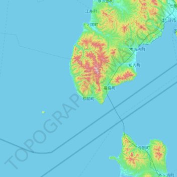
Name: 松前町 topographic map, elevation, terrain.
Location: 松前町, 松前郡, 渡島総合振興局, Präfektur Hokkaido, Japan (41.15206 139.06728 41.80404 140.25577)
Average elevation: 60 m
Minimum elevation: 0 m
Maximum elevation: 1,033 m