
Thank you for supporting this site ❤️
Make a donation
Make a donation
Gear up for your next adventure:
As an Amazon Associate, this site earns from qualifying purchases at no extra cost to you.
Pelmá topographic map
Click on the map to display elevation.
Thank you for supporting this site ❤️
Make a donation
Make a donation
Gear up for your next adventure:
As an Amazon Associate, this site earns from qualifying purchases at no extra cost to you.
About this map
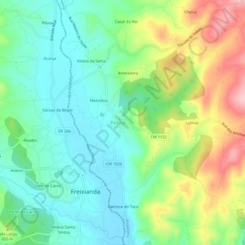
Name: Pelmá topographic map, elevation, terrain.
Location: Pelmá, Alvaiázere, Leiria, 2435-281, Portugal (39.75104 -8.47084 39.79104 -8.43084)
Average elevation: 167 m
Minimum elevation: 101 m
Maximum elevation: 296 m
Thank you for supporting this site ❤️
Make a donation
Make a donation
Gear up for your next adventure:
As an Amazon Associate, this site earns from qualifying purchases at no extra cost to you.