
Plakanciems topographic map
Interactive map
Click on the map to display elevation.
About this map
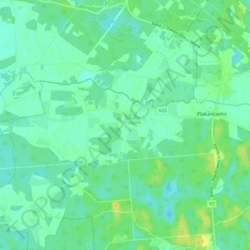
Name: Plakanciems topographic map, elevation, terrain.
Location: Plakanciems, Ķekavas pagasts, Ķekavas novads, Vidzeme, Latvia (56.74698 24.03328 56.78052 24.12613)
Average elevation: 11 m
Minimum elevation: 3 m
Maximum elevation: 27 m