
Thank you for supporting this site ❤️
Make a donation
Make a donation
Gear up for your next adventure:
As an Amazon Associate, this site earns from qualifying purchases at no extra cost to you.
Tornetti topographic map
Click on the map to display elevation.
Thank you for supporting this site ❤️
Make a donation
Make a donation
Gear up for your next adventure:
As an Amazon Associate, this site earns from qualifying purchases at no extra cost to you.
About this map
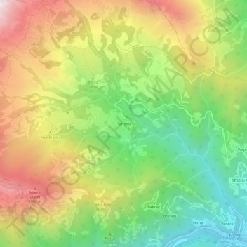
Name: Tornetti topographic map, elevation, terrain.
Location: Tornetti, Viù, Unione Montana Alpi Graie, Turin, Piedmont, Italy (45.23048 7.32159 45.27048 7.36159)
Average elevation: 1,333 m
Minimum elevation: 705 m
Maximum elevation: 2,100 m
Thank you for supporting this site ❤️
Make a donation
Make a donation
Gear up for your next adventure:
As an Amazon Associate, this site earns from qualifying purchases at no extra cost to you.