Geolocate

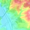
Pousos topographic map

Click on the map to display elevation.

About this map

Name: Pousos topographic map, elevation, terrain.

Location: Pousos, Leiria, Portugal (39.71756 -8.79963 39.76608 -8.73507)

Average elevation: 104 m

Minimum elevation: 31 m

Maximum elevation: 191 m

Other topographic maps

Click on a map to view its topography, its elevation and its terrain.
Santa Catarina da Serra

Portugal > Leiria > Leiria

Average elevation: 281 m

Carril

Portugal > Leiria > Leiria > Regueira de Pontes

Average elevation: 60 m

Conqueiros

Portugal > Leiria > Leiria > Souto de Carpalhosa

Average elevation: 90 m

Assenha

Portugal > Leiria > Leiria

Average elevation: 114 m

Marvila

Portugal > Leiria > Leiria

Average elevation: 107 m

Ortigosa

Portugal > Leiria > Leiria

Average elevation: 52 m

Brogal

Portugal > Leiria > Leiria

Average elevation: 82 m

Cortes

Portugal > Leiria > Leiria

Average elevation: 125 m

Cantomilo

Portugal > Leiria > Leiria

Average elevation: 120 m

Gear up for your next adventure:

🧴Sport Sunscreen Sticks - High-protection sunblock that won't run into your eyes on the trail
🧭Professional Hiking Compasses - High-precision liquid-filled compasses for map reading and orientation
☕Insulated Travel Mugs - Keep drinks hot while surveying the landscape from a summit
🗺️Scratch-off Peak Maps - Track your progress climbing Munros or Wainwrights
🕶️Polarized Sunglasses - Reduces glare from snow and water when reading terrain

As an Amazon Associate, this site earns from qualifying purchases at no extra cost to you.