
Gulmohar Park topographic map
Interactive map
Click on the map to display elevation.
About this map
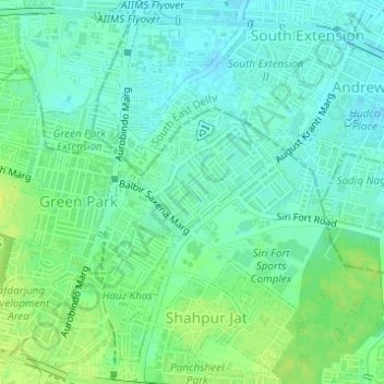
Name: Gulmohar Park topographic map, elevation, terrain.
Location: Gulmohar Park, Hauz Khas Tehsil, South Delhi, Delhi, India (28.55444 77.21002 28.55971 77.21609)
Average elevation: 221 m
Minimum elevation: 214 m
Maximum elevation: 231 m
Other topographic maps
Click on a map to view its topography, its elevation and its terrain.
Chirag Delhi
India > Delhi > Hauz Khas Tehsil
Chirag Delhi, Hauz Khas Tehsil, South Delhi, Delhi, India
Average elevation: 228 m
Hauz Khas
India > Delhi > Hauz Khas Tehsil
Hauz Khas, Hauz Khas Tehsil, South Delhi, Delhi, India
Average elevation: 225 m
Hauz Rani
India > Delhi > Hauz Khas Tehsil
Hauz Rani, Hauz Khas Tehsil, South Delhi, Delhi, 110017, India
Average elevation: 230 m
Saket
India > Delhi > Hauz Khas Tehsil
Saket, Hauz Khas Tehsil, South Delhi, Delhi, India
Average elevation: 231 m