
Jati Kesuma topographic map
Interactive map
Click on the map to display elevation.
About this map
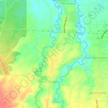
Name: Jati Kesuma topographic map, elevation, terrain.
Location: Jati Kesuma, Deli Serdang, North Sumatra, 20353, Indonesia (3.44850 98.61737 3.48850 98.65737)
Average elevation: 79 m
Minimum elevation: 51 m
Maximum elevation: 115 m