
Thank you for supporting this site ❤️
Make a donation
Make a donation
Gear up for your next adventure:
As an Amazon Associate, this site earns from qualifying purchases at no extra cost to you.
Ash Shi`b topographic map
Click on the map to display elevation.
Thank you for supporting this site ❤️
Make a donation
Make a donation
Gear up for your next adventure:
As an Amazon Associate, this site earns from qualifying purchases at no extra cost to you.
About this map
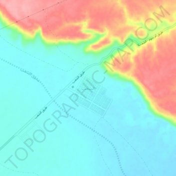
Name: Ash Shi`b topographic map, elevation, terrain.
Location: Ash Shi`b, Al Majmaah, Riyadh Region, Saudi Arabia (25.89307 45.88377 25.93307 45.92377)
Average elevation: 641 m
Minimum elevation: 605 m
Maximum elevation: 717 m
Thank you for supporting this site ❤️
Make a donation
Make a donation
Gear up for your next adventure:
As an Amazon Associate, this site earns from qualifying purchases at no extra cost to you.