
红原县 topographic map
Interactive map
Click on the map to display elevation.
About this map
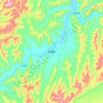
Name: 红原县 topographic map, elevation, terrain.
Location: 红原县, རྔ་བ་རྫོང་ 红原县, 阿坝藏族羌族自治州, Sichuan, China (32.63680 102.38141 32.95680 102.70141)
Average elevation: 3,692 m
Minimum elevation: 3,471 m
Maximum elevation: 4,270 m