
Thank you for supporting this site ❤️
Make a donation
Make a donation
Gear up for your next adventure:
As an Amazon Associate, this site earns from qualifying purchases at no extra cost to you.
Githunguri topographic map
Click on the map to display elevation.
Thank you for supporting this site ❤️
Make a donation
Make a donation
Gear up for your next adventure:
As an Amazon Associate, this site earns from qualifying purchases at no extra cost to you.
About this map
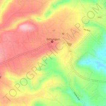
Name: Githunguri topographic map, elevation, terrain.
Location: Githunguri, Githunguri ward, Githunguri, Kiambu, Kenya (-1.06648 36.76487 -1.05377 36.78642)
Average elevation: 1,930 m
Minimum elevation: 1,821 m
Maximum elevation: 1,999 m
Thank you for supporting this site ❤️
Make a donation
Make a donation
Gear up for your next adventure:
As an Amazon Associate, this site earns from qualifying purchases at no extra cost to you.