
Tourém topographic map
Interactive map
Click on the map to display elevation.
About this map
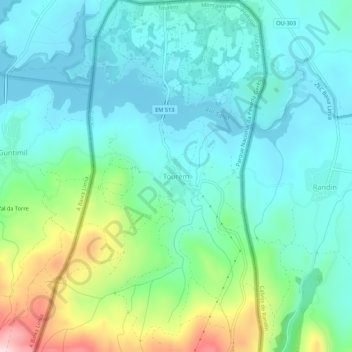
Name: Tourém topographic map, elevation, terrain.
Location: Tourém, Montalegre, Vila Real, Portugal (41.88677 -7.91750 41.92677 -7.87750)
Average elevation: 901 m
Minimum elevation: 821 m
Maximum elevation: 1,160 m