
Heufeld topographic map
Interactive map
Click on the map to display elevation.
About this map
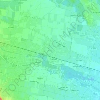
Name: Heufeld topographic map, elevation, terrain.
Average elevation: 493 m
Minimum elevation: 477 m
Maximum elevation: 542 m
Other topographic maps
Click on a map to view its topography, its elevation and its terrain.
Götting
Deutschland > Bayern > Landkreis Rosenheim > Bruckmühl
Götting, Bruckmühl, Landkreis Rosenheim, Bayern, 83052, Deutschland
Average elevation: 517 m
Jenkofen
Deutschland > Bayern > Landkreis Rosenheim > Bruckmühl > Heufeldmühle
Jenkofen, Heufeldmühle, Bruckmühl, Landkreis Rosenheim, Bayern, 83052, Deutschland
Average elevation: 501 m
Thalham
Deutschland > Bayern > Landkreis Rosenheim > Bruckmühl > Thalham
Thalham, Bruckmühl, Landkreis Rosenheim, Bayern, 83052, Deutschland
Average elevation: 538 m