
Mulvane topographic map
Interactive map
Click on the map to display elevation.
About this map
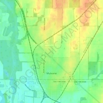
Name: Mulvane topographic map, elevation, terrain.
Average elevation: 386 m
Minimum elevation: 368 m
Maximum elevation: 406 m
Other topographic maps
Click on a map to view its topography, its elevation and its terrain.
Wichita
États-Unis d'Amérique > Kansas > Sedgwick County
Wichita, Sedgwick County, Kansas, États-Unis d'Amérique
Average elevation: 408 m
Wichita
États-Unis d'Amérique > Kansas > Sedgwick County > Wichita
Wichita, Sedgwick County, Kansas, 67202, États-Unis d'Amérique
Average elevation: 410 m