
La Maielletta topographic map
Interactive map
Click on the map to display elevation.
About this map
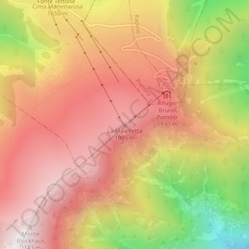
Name: La Maielletta topographic map, elevation, terrain.
Location: La Maielletta, Roccamorice, Pescara, Abruzzo, Italy (42.15752 14.12628 42.15762 14.12638)
Average elevation: 1,694 m
Minimum elevation: 987 m
Maximum elevation: 2,135 m
Other topographic maps
Click on a map to view its topography, its elevation and its terrain.