
Vandra topographic map
Interactive map
Click on the map to display elevation.
About this map
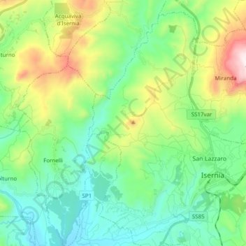
Name: Vandra topographic map, elevation, terrain.
Location: Vandra, Isernia, Molise, Italie (41.56738 14.14894 41.68101 14.25346)
Average elevation: 548 m
Minimum elevation: 255 m
Maximum elevation: 1,307 m