
Burg Loburg topographic map
Interactive map
Click on the map to display elevation.
About this map
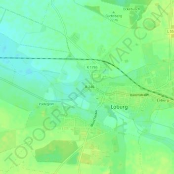
Name: Burg Loburg topographic map, elevation, terrain.
Average elevation: 77 m
Minimum elevation: 68 m
Maximum elevation: 86 m
Other topographic maps
Click on a map to view its topography, its elevation and its terrain.
Friedensau
Deutschland > Sachsen-Anhalt > Möckern > Friedensau
Friedensau, Möckern, Jerichower Land, Sachsen-Anhalt, Deutschland
Average elevation: 62 m
Büden
Deutschland > Sachsen-Anhalt > Möckern > Büden
Büden, Möckern, Jerichower Land, Sachsen-Anhalt, Deutschland
Average elevation: 61 m
Grabow
Deutschland > Sachsen-Anhalt > Möckern > Grabow
Grabow, Möckern, Jerichower Land, Sachsen-Anhalt, Deutschland
Average elevation: 60 m