Geolocate

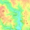
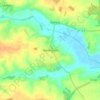
Stratton Hall topographic map

Click on the map to display elevation.

About this map

Name: Stratton Hall topographic map, elevation, terrain.

Location: Stratton Hall, East Suffolk, Suffolk, England, United Kingdom (51.98853 1.25637 52.01576 1.29185)

Average elevation: 14 m

Minimum elevation: -4 m

Maximum elevation: 31 m

Suffolk trails, hiking, mountain biking, running and outdoor activities

Other topographic maps

Click on a map to view its topography, its elevation and its terrain.

Butley Abbey

United Kingdom > England > Suffolk > East Suffolk > Butley

Average elevation: 9 m

Hulver Street

United Kingdom > England > Suffolk > East Suffolk

Average elevation: 16 m

Thorpeness

United Kingdom > England > Suffolk > East Suffolk

Average elevation: 4 m

Henstead

United Kingdom > England > Suffolk > East Suffolk

Average elevation: 13 m

Sibton Green

United Kingdom > England > Suffolk > East Suffolk

Average elevation: 35 m

Sweffling

United Kingdom > England > Suffolk > East Suffolk

Average elevation: 32 m

Eastbridge

United Kingdom > England > Suffolk > East Suffolk

Average elevation: 10 m

Benhall Green

United Kingdom > England > Suffolk > East Suffolk

Average elevation: 21 m

Somerleyton

United Kingdom > England > Suffolk > East Suffolk

Average elevation: 9 m

Hinton

United Kingdom > England > Suffolk > East Suffolk > Blythburgh

Average elevation: 19 m

Kelsale

United Kingdom > England > Suffolk > East Suffolk

Average elevation: 32 m

Wangford

United Kingdom > England > Suffolk > East Suffolk

Average elevation: 13 m

Wenhaston

United Kingdom > England > Suffolk > East Suffolk

Average elevation: 16 m

Thorpeness

United Kingdom > England > Suffolk > East Suffolk

Average elevation: 4 m

Wangford

United Kingdom > England > Suffolk > East Suffolk

Average elevation: 13 m

Sizewell

United Kingdom > England > Suffolk > East Suffolk > Leiston

Average elevation: 5 m

Sweffling

United Kingdom > England > Suffolk > East Suffolk

Average elevation: 32 m

Sizewell

United Kingdom > England > Suffolk > East Suffolk > Leiston

Average elevation: 5 m

Wangford

United Kingdom > England > Suffolk > East Suffolk

Average elevation: 13 m

Gear up for your next adventure:

🧘Folding Sit Mats - Dry and warm seat for map-reading breaks on damp ground
📷Camera Straps - Secure straps for carrying cameras while walking
🚲Cycling GPS Computers - Track elevation and topographic routes on two wheels
📕Outdoor Navigation Books - Learn traditional and modern navigation techniques
🔦Head Torches - Hands-free lighting for hiking and camping

As an Amazon Associate, this site earns from qualifying purchases at no extra cost to you.