
Sulden - Solda topographic map
Interactive map
Click on the map to display elevation.
About this map
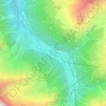
Name: Sulden - Solda topographic map, elevation, terrain.
Average elevation: 2,232 m
Minimum elevation: 1,682 m
Maximum elevation: 3,311 m
Other topographic maps
Click on a map to view its topography, its elevation and its terrain.
Passo dello Stelvio
Italy > Trentino-Alto Adige/Südtirol > South Tyrol > Stilfs - Stelvio
The Stelvio Pass (Italian: Passo dello Stelvio [passo ˈdello ˈstɛlvjo], Giogo dello Stelvio [dʒɔgo ˈdello ˈstɛlvjo]; German: Stilfser Joch; [ˈʃtɪlfsɐ jɔx]) is a mountain pass in northern Italy bordering Switzerland at an elevation of 2,757 m (9,045 ft) above sea level. It is the highest paved…
Average elevation: 2,724 m