Geolocate

Kfar Daniel topographic map

Click on the map to display elevation.

About this map

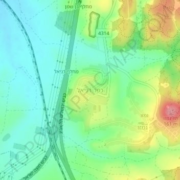
Name: Kfar Daniel topographic map, elevation, terrain.

Location: Kfar Daniel, Hevel Modiin Regional Council, Ramla Subdistrict, Center District, Israel (31.92989 34.92872 31.93668 34.93588)

Average elevation: 90 m

Minimum elevation: 55 m

Maximum elevation: 161 m

Other topographic maps

Click on a map to view its topography, its elevation and its terrain.

Gear up for your next adventure:

🔋Lithium AA Batteries - Long-lasting power that performs well in cold mountain weather
🧭Orienteering Compasses - Accurate compasses for map-based navigation
🧺Microfibre Travel Towels - Fast-drying and compact towels for wild swimming and camping
🕶️Polarized Sunglasses - Reduces glare from snow and water when reading terrain
GPS Outdoor Watches - Watches with GPS tracking for hiking and exploration

As an Amazon Associate, this site earns from qualifying purchases at no extra cost to you.