
Pontecuti topographic map
Interactive map
Click on the map to display elevation.
About this map
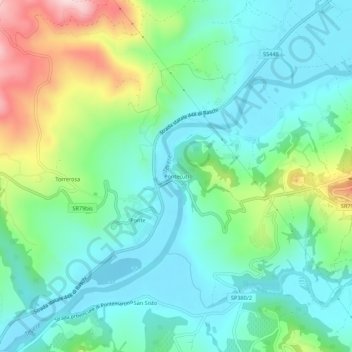
Name: Pontecuti topographic map, elevation, terrain.
Location: Pontecuti, Todi, Perugia, Umbría, 06059, Italia (42.76102 12.35526 42.80102 12.39526)
Average elevation: 223 m
Minimum elevation: 133 m
Maximum elevation: 462 m