
Kurth Lake topographic map
Interactive map
Click on the map to display elevation.
About this map
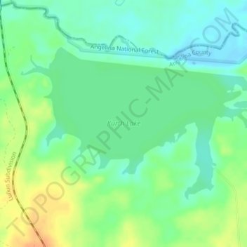
Name: Kurth Lake topographic map, elevation, terrain.
Location: Kurth Lake, Angelina County, Texas, United States (31.43333 -94.70783 31.45215 -94.67219)
Average elevation: 61 m
Minimum elevation: 47 m
Maximum elevation: 83 m
Other topographic maps
Click on a map to view its topography, its elevation and its terrain.
Lufkin
United States > Texas > Angelina County
The elevation of Lufkin is 139 to 404 ft above mean sea level.
Average elevation: 88 m