
Ostrzeszów topographic map
Interactive map
Click on the map to display elevation.
About this map
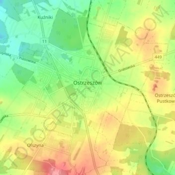
Name: Ostrzeszów topographic map, elevation, terrain.
Average elevation: 213 m
Minimum elevation: 171 m
Maximum elevation: 262 m
Other topographic maps
Click on a map to view its topography, its elevation and its terrain.
Kobyla Góra
Poland > Greater Poland Voivodeship > Ostrzeszów County
Kobyla Góra, gmina Kobyla Góra, Ostrzeszów County, Greater Poland Voivodeship, 63-507, Poland
Average elevation: 220 m