
Ezequiel Montes topographic map
Interactive map
Click on the map to display elevation.
About this map
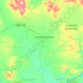
Name: Ezequiel Montes topographic map, elevation, terrain.
Location: Ezequiel Montes, Querétaro, Mexico (20.53861 -99.99157 20.76715 -99.73527)
Average elevation: 2,024 m
Minimum elevation: 1,809 m
Maximum elevation: 2,600 m
Other topographic maps
Click on a map to view its topography, its elevation and its terrain.