
Sarez Lake topographic map
Interactive map
Click on the map to display elevation.
Sarez Lake
Sarez Lake (Tajik: Сарез кӯл, romanized: Sarez Kūl) is a lake in Rushon District of Gorno-Badakhshan province, Tajikistan. Length about 75.8 kilometres (47.1 mi), depth few hundred meters, water surface elevation about 3,263 metres (10,705 ft) above sea level and volume of water is more than 16 cubic kilometres (3.8 cu mi). The mountains around rise more than 2,300 metres (7,500 ft) above the lake level.
About this map
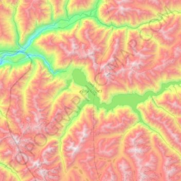
Name: Sarez Lake topographic map, elevation, terrain.
Average elevation: 4,302 m
Minimum elevation: 2,565 m
Maximum elevation: 5,886 m
Other topographic maps
Click on a map to view its topography, its elevation and its terrain.
Independence Peak
Tajikistan > Gorno-Badakhshan Autonomous Region > Rushon District
Average elevation: 6,373 m