Geolocate

Rodeiro topographic map

Interactive map

Click on the map to display elevation.

About this map

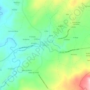
Name: Rodeiro topographic map, elevation, terrain.

Location: Rodeiro, Deza, Pontevedra, Galicia, 36530, España (42.62904 -7.96817 42.66904 -7.92817)

Average elevation: 685 m

Minimum elevation: 586 m

Maximum elevation: 890 m

Other topographic maps

Click on a map to view its topography, its elevation and its terrain.

Vila de Cruces

España > Galicia > Deza

Vila de Cruces, Deza, Pontevedra, Galicia, 36590, España

Average elevation: 452 m

Santa Cristina

España > Galicia > Deza

Santa Cristina, Lamela, Silleda, Deza, Pontevedra, Galicia, 36579, España

Average elevation: 350 m