

Gregory topographic map
Click on the map to display elevation.
About this map

Name: Gregory topographic map, elevation, terrain.
Location: Gregory, San Patricio County, Texas, 78359, United States (27.90916 -97.30943 27.93702 -97.27648)
Average elevation: 10 m
Minimum elevation: 7 m
Maximum elevation: 15 m
Other topographic maps
Click on a map to view its topography, its elevation and its terrain.
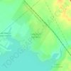

Garza-4th-6th Streets Colonia
United States > Texas > San Patricio County > Ingleside
Average elevation: 7 m